The Engerle Protocol
Breitenberg's Most Technical Launch: A Brutal Audit
Breitenberg's Most Technical Launch: A Brutal Audit
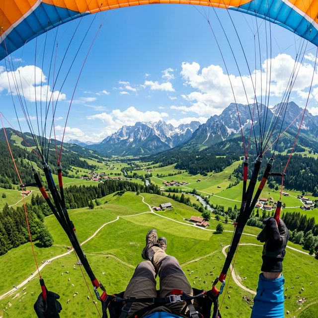
The Breitenberg offers benign pastoral views from the valley, but the "Engerle" launch site is a wolf in sheep’s clothing. Located at the apex of the mountain (1,760m), just below the Ostlerhütte, it is not a manicured carpet for beginners. It is a funnel-shaped geographical feature that terminates in a vertical drop-off.
This dossier is for the "Sichere Starter" (Confident Launcher). The Engerle demands a precise reverse inflation, instant pitch control, and the psychological fortitude to commit to a run that offers no slide-out zone. If you blow the launch here, you are in the rocks. But if you nail it, you are instantly connected to the Breitenberg's legendary thermal engine, with direct access to the Aggenstein face and the high Alps.
| Parameter | Specification |
|---|---|
| Altitude | 1,760m AMSL |
| Wind Window | Strictly East (10-15 km/h ideal) |
| Difficulty | DHV "Schwer" (Difficult) |
| Access Hike | 15-20 mins steep uphill from Hochalpbahn |
| Required Docs | License, Insurance, & "Green Card" (Local briefing card) |
Step 1: Take the Breitenbergbahn (Gondola) + Hochalpbahn (Chairlift) to the top
station.
Step 2: The Filter. You must hike 15-20 minutes uphill towards the Ostlerhütte.
This physical exertion at 1,600m+ means you arrive at launch with an elevated heart rate. Stabilize
your breathing before hooking in. "Hike & Fly" lightweight gear is a massive advantage here.
You cannot just show up and fly. The local club (Ostallgäuer Gleitschirmflieger) requires a "Green
Card" (Einweisungskarte). This proves you've received a site briefing.
Where to get it: At the valley station ticket office or the flight school. It costs a
nominal fee (deposit) or is part of the landing card purchase.
The parking at the valley station costs €5.00. Buying a lift ticket entitles you to a €2.00 refund. You must present the parking stub tear-off at the window. Do not forget this; it's the "local's discount."
The Thermal Trigger: Once airborne, the Aggenstein (the rocky peak behind you) is the primary engine. In unstable air, the heat wicks up the rock face. Transitioning from the soaring ridge to the thermal core allows for altitude gains of 2,000m+.
The Landing: The valley landing zone (Landeplatz) in Pfronten-Steinach is huge, flat, and forgiving—a stark contrast to the launch. It's a 3-minute walk back to the lift, enabling efficient "lap" flying if you have the stamina for the hike back up to Engerle.
Plan B (The Backup): If you hike up and find the wind is North (Bayerischer Wind), DO NOT force the Engerle launch. Walk back down to the Kesselmoos launch (lower plateau). It takes North wind safely. Walking down is better than rotor-induced collapse.
Spot: Ostlerhütte (1,838m)
The Move: If you top-land (experts only) or hike without flying, the Kaiserschmarrn here is legendary. The terrace offers 360-degree views of the flight path.
Spot: Gasthof Aggenstein
The Move: Located near the landing zone. This is where pilots gather to analyze flight traces and drink Radlers.