The "Riviera" Reality Check
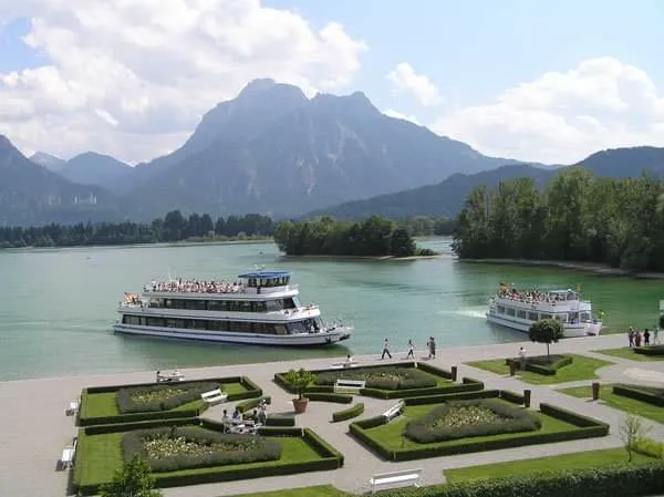
Hopfen am See markets itself as the "Riviera of the Allgäu"—Mediterranean flair, crystal waters, seamless alpine vistas. The reality is more nuanced. The north shore promenade offers undeniable beauty and one of Bavaria's most famous panoramas, but it's a highly developed, high-traffic zone that feels more urban park than wilderness. The true value for the serious hiker lies in the southern woodlands and the medieval castle ascent—areas often neglected in tourist summaries.
The Modular Network
"Family Trail" conflates THREE systems: flat Hopfensee Circuit, vertical Burgruine ascent, and Forggensee connector. Treat as modules—assemble to fit weather, fitness, time.
The Seasonal Lake Trap
Forggensee is drained Oct-May (reservoir management). "Panoramaweg" in March = barren mudscape, not turquoise water. ONLY full June-October.
The High-ROI Hike
Maximum view for minimum sweat. Culture (11th-century castle), nature (glacial lake), infrastructure (waterfront coffee). One of best return-on-investment hikes in region.
The Parking Battlefield
P1 Campingplatz (East Shore) is tactical choice. ~135 spaces, €5/day. Fills later than promenade. Promenade = tourist trap, tight parallel parking, premium pricing.
Forggensee Timing
Reservoir only FULL mid-June to mid-October. Winter = exposed gravel banks, tree stumps, Roman road foundations. Water recedes into vast mudscape.
Castle Worth It?
YES if clear weather—supreme vantage, optical illusion of lake at foot of Alps. NO if hazy/clouds below 1000m—view is the payoff, ruins are minimal.
Guest Card Hack
Füssen Card or Königscard = FREE bus on Line 56. Avoid parking melee entirely. Transforms backup plan into primary strategy.
TALE OF TWO LAKES: Hydrological Intelligence
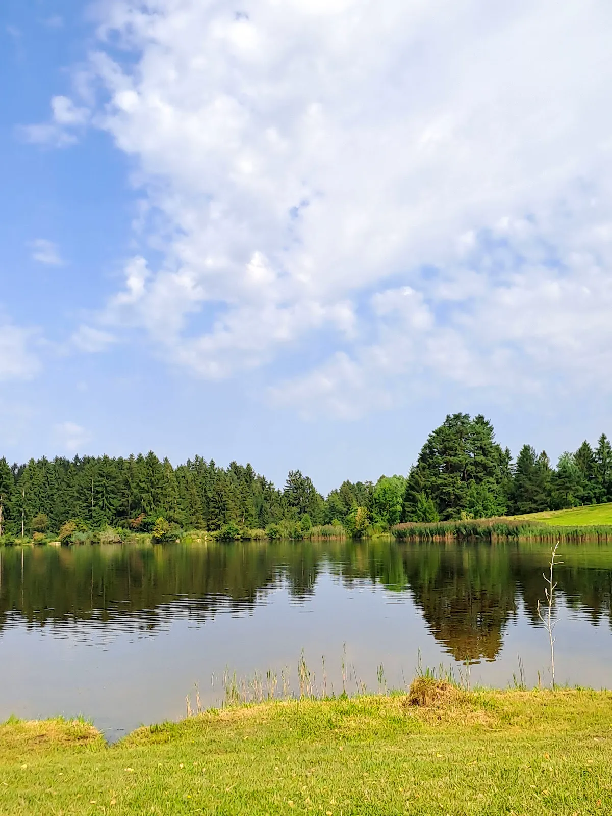
Hopfensee (Glacial Relic): Natural lake with stable year-round levels. Reliable anchor of hike—will look like a lake in any month. Shallow, warm, one of Bavaria's warmest.
Forggensee (Industrial Giant): Artificial reservoir dammed in 1950s. SEASONAL LAKE. Drained Oct-May for snowmelt capture. The "turquoise water" brochures only apply June-October. March visitors expecting blue paradise find lunar landscape of gravel and old tree stumps.
Trail Profile: The Hard Numbers
| Metric | Value | Analysis |
|---|---|---|
| Total Distance | 8.2-11.5 km | Standard loop + castle = 8.2km. Forggensee extension adds 4-6km. |
| Elevation Gain | ~140m | Concentrated entirely in castle ascent. Lake circuit is virtually flat. |
| Terrain | 60/30/10% | 60% paved promenade, 30% gravel forest road, 10% rooty alpine path (castle) |
| Technical Rating | T1 (loop) / T2 (castle) | Castle spur has roots, gradients, potential mud. Not stroller-friendly. |
| Crowd Index | Severe → Light | Promenade = extreme. South shore = moderate. Forggensee connector = light. |
Trail Segment Analysis
Segment 1: The Promenade (North Shore)
- Character: Urbanized, paved, exposed. Wide walkway between lake and road.
- View Payoff: Unobstructed southern views across lake to Alps. Classic postcard angle. Best mountain reflections.
- Crowd Factor: EXTREME. E-bikes, strollers, dogs, tour groups.
- Noise: Constant road noise from Uferstraße. NOT a quiet nature walk.
- Strategy: Use as warm-up. Buy supplies here—no shops on south shore.
Segment 2: East Bay (Transition Zone)
- Surface: Asphalt gives way to gravel past Campingplatz. Trail enters reed beds.
- Ecological Note: Bird sanctuary. Dogs must be leashed. Reeds block lake view but offer wind protection.
- Stroller Intel: Compacted gravel. Plastic wheels will vibrate; air-filled tires preferred.
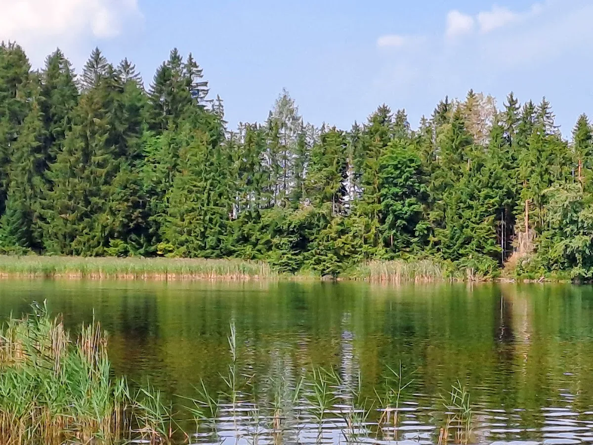
Segment 3: South Shore (The Forest Path)
- Character: Woodland, rooty, shaded. Most enjoyable for true hikers.
- Environment: Mixed forest of spruce and beech. Significantly cooler in summer.
- Technical Warning: Labeled "stroller friendly" but sections have exposed roots. Rugged off-road stroller: yes. Lightweight city buggy: will struggle.
- Tranquility: Road noise fades. Crowds thin as casual walkers turn back.
The Vertical Objective: Burgruine Hopfen
The Climb
- Decision Point: Near west end of lake (Fachklinik Enzensberg). Signs point uphill toward "Burgruine." Straight = flat loop. Uphill = the ascent.
- Elevation: 100-140m gain over short distance. Moderate to steep switchbacks.
- Surface: Dirt and forest floor. Muddy/slippery after rain. NOT stroller-friendly.
- Effort: 20-30 minutes for healthy adult.
The Reward: Oldest Stone Castle in Allgäu
- History: Legitimate 11th/12th-century medieval ruin (unlike 19th-century romantic Neuschwanstein). Seat of Lords of Hopfen. Destroyed in Peasants' War (1525), later used as quarry.
- The View: SUPREME vantage of entire network. Look down on Hopfensee with optical illusion that lake sits directly at foot of high Alps. Lake → green foothills → grey limestone peaks = perfect layering.
- Neuschwanstein Bonus: From northern wall remnants, Neuschwanstein and Hohenschwangau visible as distant white specks—context of castles nestled in vast mountain range.
Skip Decision
If weather is hazy or cloud ceiling below 1000m, skip the climb. View is the primary payoff; ruins themselves are minimal compared to other German castles.
Forggensee Extension: Worth It?
The Route
- Start: Eastern Hopfensee (near Campingplatz), trail northeast toward Eschach
- Distance: Adds 4-6 km round trip
- Terrain: Rolling pastureland, farm tracks. Open, exposed to sun.
- Payoff: Western shore of Forggensee—different angle on mountains, vast reservoir expanse
| Verdict | Condition |
|---|---|
| YES | Goal is 15km+ workout AND Forggensee is FULL (July-Sept). Contrast between intimate Hopfensee and massive Forggensee is striking. |
| NO | Casual walker OR Forggensee drained (Oct-May). Walking 3km across open fields to see mud pit = morale killer, especially for children. |
Tactical Logistics
The Parking Reality
Sunny weekends: capacity exceeded by 10:00 AM. Choose wisely:
| Lot | Cost | Verdict |
|---|---|---|
| P1: Campingplatz/East Shore | ~€5/day | TACTICAL CHOICE. ~135 spaces. Fills later. Direct access to wilder south shore and Forggensee connector. |
| P2: West Shore/Sports Ground | Varies | "Free parking" is a MYTH from old guidebooks. Now monetized. €30+ fine risk > €5 fee. |
| P3: Promenade/Center | Premium | AVOID. Tourist trap pricing. Parallel parking with buses. High stress. |
Public Transit
- Line: RVA Bus 56 (Füssen – Hopfen – Pfronten)
- Frequency: Irregular—check DB Navigator app for real-time. Clusters of service followed by midday gaps.
- Stops: "Hopfen, Uferstr./Höhenstr." (castle start), "Hopfen, Campingplatz" (lake loop start)
- Guest Card: Füssen Card or Königscard = FREE. Primary strategy for parking avoidance.
Operational Timing
The Golden Window (Late May – Early Oct)
Everything open. Ferries running (from June 1st). Landscape lush green. Trade-off: Maximum crowd density. Parking is primary challenge. Only time for "Two Lake" strategy.
Shoulder Season (Apr/May, Late Oct/Nov)
Hopfensee beautiful. Crisp air, better visibility than humid summer. Risk: Forggensee empty/low. Castle path may have snowmelt mud. Solitude: Might have south shore to yourself on weekday.
Time of Day
- Photographer's Hour: SUNSET superior. Sun sets west, illuminates Alpenglow on Säuling and Tannheim peaks. Castle ruins = prime sunset spot.
- Hiker's Hour: Start 08:30. Beat parking rush (critical weekends). Finish promenade before tour buses. Guarantee south shore stillness.
Combo Strategies
The "Sandwich" Strategy (Recommended)
Start with wilder South Shore (bottom bread), ascend the Castle for view (meat), finish with Promenade stroll (top bread) as cool down.
Do NOT reverse: Ending with south shore feels anticlimactic. Ascending castle first thing with cold legs is harsh.
Post-Hike Swim
Strandbad Hopfen (Lido) on north shore. Shallow entry, warm water. Perfect bribe for children after the hike.
Town Combo
Füssen Old Town is 10 minutes away. Morning hike in Hopfen + afternoon exploring High Castle (Hohes Schloss) of Füssen.
Infrastructure & Supply
Gastronomy
| Zone | Character | Intel |
|---|---|---|
| Promenade (North) | Tourist Zone | Dozens of cafes. Paying for view. Fischerhütte: high volume, fish-centric, reservations essential peak season. "Cash is King" for kiosks. |
| South/East Shore | Hiker's Choice | Landhotel Wiesbauer: rustic Bavarian, solid Käsespätzle, venison. Great mid-hike stop for Forggensee extension. |
On-Trail Provisions
- Water: NO reliable springs or fountains on south shore. Bring 1L per person.
- Toilets: Promenade (Tourist Info) and Campingplatz. South shore has NO facilities.