
What This Is
Kappeler Alm is NOT designed for the leisurely tourist. Unlike the neighboring Breitenbergbahn where a credit card transaction facilitates a gondola ride to the summit for a sterile descent, Kappeler Alm represents an "Earn Your Turn" experience—a throwback to a grittier, more authentic era of winter sports. If your objective is a pristine, manicured Disneyland attraction with safety netting at every turn, direct your attention elsewhere. However, if your ambition involves sweating for ninety minutes of vertical ascent, consuming the finest vegetarian cuisine in the Alps at the first vegetarian mountain hut, and subsequently careening down a forest road on a wooden sled at forty kilometers per hour while navigating around winter hikers, this destination is precisely aligned with your mission profile. There is no chairlift, no gondola, no magic carpet. This "Filter Effect" eliminates ninety percent of the "Jerrys"—the clueless, dangerous novices who clog commercial slopes.
The Schalenggen Legacy
Pfronten is the ancestral home of the Schalenggen—substantial wooden horn sleds originally used to transport hay and timber from high alpine pastures. The annual "Schalenggenrennen" is a cultural touchstone. You're traversing the same trade routes where farmers once risked life and limb.
Raw Dog Sledding
This is not a dedicated, closed-course bobsled track. It is the Ostlerforstweg—a forest road that is chaotic and magnificent. No safety nets on many corners. A missed turn results in an intimate introduction to a spruce tree. Unfiltered, unforgiving.
The Speed Equation
On a cold morning following a freeze-thaw cycle, the track transforms into a bobsled run. Riders can easily achieve 40-50 km/h. The thrill is derived from the proximity of the forest and the uncontrolled variables—backcountry, not roller coaster.
Adrenaline Audit Score
Thrill Factor: 7.5/10 (velocity depends on ice). Sweat Equity: 9/10 (no lift—you walk or don't ride). Wallet Impact: Low. Instagram Potential: 8.5/10 (Ruine Falkenstein views).
Track Specifications
Length: 4-5 km. Vertical: 450m (1,350m to 900m). Hike Duration: 1.5-2.5 hours ascent (with sled). Surface: Packed forest road, potentially iced.
Critical Costs (CASH ONLY)
Parking: ~€5/day (PSA-Ticket, strict enforcement). Sled Rental: €5-10/day (rent in town, NOT at Alm). Food: €30-40 budget. No 200/500€ bills accepted.
Season Window
Best: mid-January to late February. Worst: December (too warm, slush), March (morning ice to noon slush). Check webcam: Breitenberg as proxy. Best time of day: 9 AM (fastest/iciest).
The Ascent: Earn Your Turn (The Brutal Truth)
Google Maps may euphemistically describe this as a "walk." The reality is more akin to a winter expedition.
| Metric | Value | Reality Check |
|---|---|---|
| Starting Point | Wanderparkplatz Pfronten-Kappel | Terminus of Bürgermeister-Franz-Keller-Straße |
| Distance | ~4 km to summit | Deceptively short metric that belies the effort |
| Hiking Time Estimate | 1.5 hours (official) | Assumes high fitness, minimal load. With heavy sled, oversized boots, and photo stops: 2-2.5 hours realistic. |
| Summit Elevation | Kappeler Alm: 1,350m | Also: Hündeleskopfhütte at 1,198m (halfway junction) |
The Traction Issue
The same path used for ascent is the descent path—or runs parallel to it. The surface becomes polished and extremely slippery. Athletic sneakers are entirely insufficient and dangerous. Attempting to hike up a polished icy toboggan track in street shoes is a recipe for humiliating and uncontrolled slide back to the parking lot.
PRO TIP: Carry "Grödel" (micro-spikes) for your boots. Available for ~€30, they make the hike 50% easier and significantly safer. At absolute minimum: sturdy hiking boots with deep lugs are mandatory.
The Junction Decision
Roughly halfway up (45-60 minutes), you reach a critical junction:
- Left/Straight: Hündeleskopfhütte at 1,198m (vegetarian hut)
- Right/Upwards: Kappeler Alm at 1,350m (full summit)
Strategic Warning: While many stop at Hündeleskopfhütte on the descent, stopping there on the ASCENT can be a tactical error. Once you sit in the warmth and consume a heavy meal, summoning the will to complete the remaining vertical to Kappeler Alm becomes mentally devastating. Push directly to the top first to secure the full run.
The Drop: Difficulty and Technical Requirements
The official rating is "Medium" or "Sporty." The reality on the ground leans heavily towards "Technical."
Track Characteristics
- NOT a wide, banked ski slope designed with forgiveness
- Forest road with "guard rails" consisting merely of snowbanks
- Snowbanks often border steep drop-offs on the valley side
- Blind corners—"blind-firing" (entering at speed where stopping is impossible within visible distance) is negligent and dangerous
The "Shared Space" Conflict
CRITICAL: This is a shared trail. Riders will inevitably encounter hikers walking UP while sledding DOWN. The general rule: downhill traffic yields, or at minimum must be in full control to avoid uphill pedestrians. You are NOT alone on this mountain.
Equipment Requirements
| Equipment | Recommendation | Warning |
|---|---|---|
| Sled Type | Steerable sled (Lenkrodel) highly recommended | Cheap plastic shell toboggans ("swimming pools") are borderline suicidal—zero directional control on ice, rider becomes passenger of physics. |
| Footwear | Sturdy, stiff-soled mountain boots | Snowboard boots too soft to dig into ice. Ski boots too rigid—prevent ankle flex for steering/braking. |
| Following Distance | Maintain safe gap behind other riders | Sled collisions are leading cause of injury. If companion crashes ahead at 30 km/h, tailgating = dual hospitalization. |
Night Operations
Night riding is popular but brings additional challenges:
- Track is NOT floodlit like a commercial ski slope
- Must bring high-intensity headlamp (300+ lumens minimum)
- Descending into pitch-black void at speed is not adrenaline—it is a fundamental failure of risk management
The Hut Dilemma: Vegetarian Innovation vs. Traditional Fare
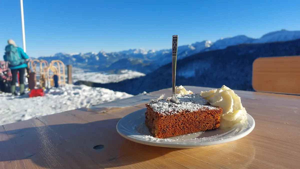
In a region famous for Schweinshaxe (pork knuckle) and Wurstsalat (sausage salad), the Hündeleskopfhütte made headlines by becoming the first vegetarian mountain hut in the Alps.
| Venue | Elevation | Description | Hours |
|---|---|---|---|
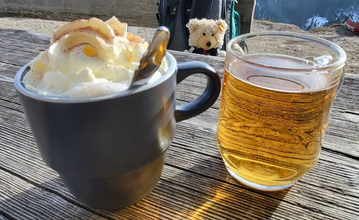
| Hündeleskopfhütte | 1,198m | First vegetarian alpine hut. Rustic, cozy. Kaspressknödel, spinach dumplings, vegan cakes, lentil stews. Kaiserschmarrn is world-class. Even carnivores find it legitimate—hearty, heavy, carb-loaded fuel perfect for winter. | Check social media before hiking |
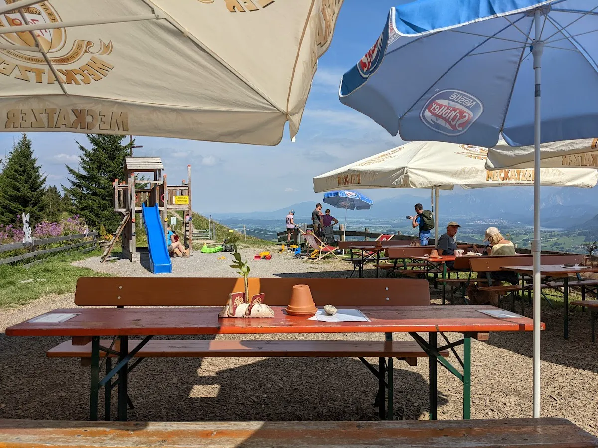
| Kappeler Alm | 1,350m | Traditional experience. Higher, windier, superior panoramic views. Standard Bavarian fare, excellent soups. Closed Monday-Wednesday (except holidays/Carnival week). | Thu-Sun typically |
CASH ONLY WARNING: Both huts are CASH ONLY. Remote locations lack connectivity for digital transactions. Kappeler Alm specifically refuses 200€ and 500€ banknotes. Carry small denominations. Budget €30-40 per person.
The Competitor: Breitenbergbahn vs. Kappeler Alm
Why choose Kappeler when the famous Breitenbergbahn is nearby?
| Feature | Breitenbergbahn | Kappeler Alm |
|---|---|---|
| Access | Gondola + Chairlift (Passive) | Hike (Active) - NO lifts |
| Length | ~6 km (Longest in Allgäu) | ~4-5 km |
| Crowds | High (Tourists, Families) | Medium/Low (Locals, Hikers) |
| Cost | Lift Ticket (~€20-30) | Parking (~€5) + Physical Exertion |
| Vibe | Commercial Ski Resort | Backcountry Soul |
| Food | Big Panoramas, Crowded Huts | Cozy, Vegetarian Options |
| Rentals | Easy (at Valley Station) | Difficult (Bring your own) |
Conclusion: Breitenbergbahn is superior for families, those who dislike hiking, or thrill-seekers wanting to maximize vertical meters by doing five runs in a day. Kappeler Alm is the choice for those who want one meaningful, high-quality run, detest crowds, and value the physical accomplishment of the hike as much as the adrenaline of the descent.
Weather and Seasons: The Window of Opportunity
Operating at 900-1,350m, this is "low mountain" range—susceptible to the "Green Winter" phenomenon.
The Climate Reality
| Period | Conditions | Assessment |
|---|---|---|
| Mid-January to Late February | Best window for reliable snow cover | OPTIMAL SEASON |
| December | Often too warm | Slush conditions |
| March | Morning ice turns to "slush soup" by noon | Risky—timing critical |
Time of Day Strategy
| Time | Conditions | Crowd Level |
|---|---|---|
| 9:00 AM | Fastest, hardest, iciest—prime window for adrenaline | Fewest people |
| 12:00 PM | Sun has softened snow—slushy, slower | Crowded with hikers |
| Evening/Night | Magical but dangerous—melted snow refreezes to ice | Requires 300+ lumen headlamp |
WEBCAM WARNING: Driving to trailhead without checking live feeds is a rookie mistake. The Breitenberg Webcam serves as good proxy for Kappeler conditions. If Breitenberg bottom looks brown and muddy, lower Kappeler sections are likely unrideable.
The "Kappel" Wind
The valley is known for Föhn winds, which can raise temperatures to +10°C even when it's -5°C in Füssen. Check the wind forecast—if the Föhn is blowing, snow turns to glue, ruining the sledding experience.
Gear Guide: The Survival Kit
Arriving in jeans and sneakers is not merely a fashion faux pas—it is a safety hazard that will result in misery.
| Item | Requirement | Notes |
|---|---|---|
| Footwear | Waterproof Hiking Boots (Wanderschuhe) | Non-negotiable. Moonboots = no ankle support. Sneakers = dangerous. |
| Traction | Grödel (Micro-spikes) | ~€30 game-changer. Makes hike 50% easier and significantly safer. |
| Vision | Ski Goggles | Essential. 30 km/h generates snow spray that blinds rider. Sunglasses will fall off. |
| Head | Helmet | Natural track lined with trees and ice. Basic safety requirement. Also keeps ears warm. |
| Hands | Two pairs of gloves | Thin breathable for hike (manage sweat). Thick waterproof mittens for descent (wind chill). |
| Pants | Ski Pants or rain pants over sweatpants | Sled runners spray snow directly onto legs—jeans soaked within minutes. |
Sled Rental Locations
- Sport Manhard (Pfronten-Ried) or other Pfronten sport shops
- Rental Cost: €5-10/day
- Warning: Kappeler Alm is NOT a commercial rental station. Bring your own or rent in town.
- Quality Matters: Cheap plastic bob leads to poor experience. High-quality wooden Davos sled: €60-80 to purchase.
Content Creation Gold: The "Shot" List
Three specific spots yield the highest engagement:
- The Ruine Falkenstein View: On hike up, there's a clearing looking across the valley at the highest castle ruin in Germany. In winter mist, this shot is dramatic and moody.
- The "Hündeleskopf" Sign: The vegetarian hut features distinctive branding. Photo of the "Vega-Brot" with snowy mountains in background = excellent lifestyle content.
- The "Action Cam" Angle: Mount GoPro on FRONT of sled facing back at rider— compelling low-angle shot that emphasizes speed and reaction.
Phone Rules
- Cold weather depletes lithium-ion batteries rapidly
- Keep phone in internal pocket close to body heat—backpack = dead battery by summit
- Reception spotty in forest but generally good at the Alm
- Relying on live-streaming entire descent is risky
Final Mission Checklist
- Check Webcam and Snow Report (via Breitenbergbahn site)
- Withdraw CASH (ensure notes are €50 or smaller)
- Rent Sled in Town (Sport Manhard or similar)
- Park in Kappel (Purchase PSA-Ticket)
- Hike (Apply Grödel for traction)
- Refuel (Consume dumplings at Hündeleskopf)
- Ride (Helmet on, Goggles down)
- Document (Caption: "Earned it.")
Kappeler Alm serves as the antidote to the sterilized, expensive, and crowded mega-resorts. It is authentic, slightly chaotic, physically demanding, and visually stunning. It is not designed for the "Prada Ski Suit" demographic—it is for the "Gore-Tex and duct tape" crowd.