What This Is
In the saturated market of Alpine tourism, the distinction between legitimate adrenaline objective and manufactured "theme experience" is often obscured by slick marketing. The Schmugglersteig (Smuggler's Trail) presents a complex case study: it is NOT, by any technical definition, an "adrenaline rush." It is a gamified, narrative-driven hiking loop designed primarily for multi-generational engagement rather than vertical athletic performance. However, dismissing it entirely would be a strategic error. Its value lies not in the trail itself, but in its utility as a gateway asset: a low-barrier acclimatization route, a high-yield content creation zone on the Austro-German border, and a logistical anchor for the genuine high-consequence terrain that surrounds it. If the definition of "thrill" involves exposure to height, technical rock scrambling, or speed, the Schmugglersteig fails the audit. It is a Class T1 hiking trail. The "danger" is effectively zero. The "adventure" is simulated through role-playing elements rather than physical obstacles.
The Core Contradiction
A "Scenic Cruiser" in a region known as a "Climbers' Paradise." For thrill-seekers, it should be marketed as "Active Recovery" or "The Warm-Up," never as the main event. Best paired with Salewa Klettersteig for a proper mission.
The Historical Hook
The Wannenjoch-Iseler ridge forms the physical Austro-German border. In the 19th century, "Schwärzer" (smugglers—named for soot rubbed on faces) used these ridges to bypass valley customs. Walking the path knowing locals once risked prison or gunfire adds sombre undertone.
The Visual Payoff
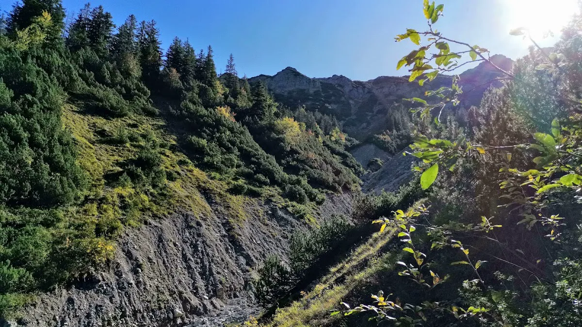
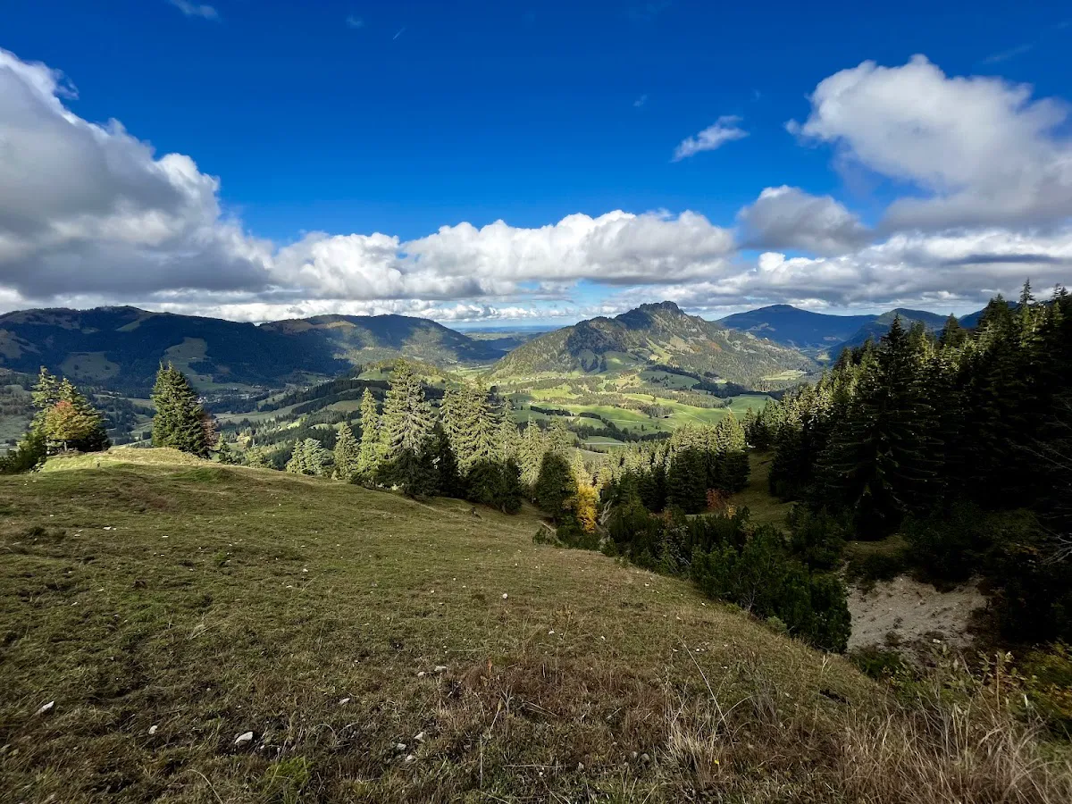
9/10 for visuals despite 2/10 for adrenaline. The bi-national panorama is the USP: pastoral green Allgäu to the north vs. jagged limestone Vilsalpsee group to the south. Superior to most forest-bound ropes courses where trees block views.
Trail Specifications
Distance: 4.3 km one-way. Grading: T1 (Easy). Elevation: ~200m undulation. Route: Wannenjochbahn (Schattwald) to Iselerbahn (Oberjoch). Linear route requires bus transfer.
Lift Economics
Wander-Ticket: ~€30 adult (ascent one + descent other). Family of 4: €80-90 on lifts alone. Parking: €5-7/day. Bus Transfer: Free with Gästekarte, or €3-5 for day-trippers.
Best Timing
Best Month: September - mid-October (Föhn winds clear haze, autumn colors, reduced crowds). Worst Month: August (conga line of tourists, heat, afternoon storms). Lift Hours: 08:40 - 16:30.
Thrill Assessment
For Thrill Seekers: NO. It's a rest day activity. For Families: YES—one of the best theme trails in the Alps. For Content Creators: MAYBE—high visual yield despite low adrenaline.
The Adrenaline Audit: Comparative Analysis
The Tannheimer Tal is known as a "Climbers' Paradise" with some of the best limestone climbing in the Northern Alps. Against this backdrop, the Schmugglersteig is the baseline.
| Feature | Schmugglersteig | Friedberger Klettersteig | Lachenspitze Nordwand | Salewa Klettersteig |
|---|---|---|---|---|
| Classification | Hiking Trail (T1) | Via Ferrata (B) | Via Ferrata (C/D) | Via Ferrata (B/C) |
| Exposure | Low (Wide Ridges) | Moderate (Secured) | High (Vertical Walls) | Moderate (Exposed) |
| Physical Demand | Low (Walking) | Medium (Scrambling) | High (Vertical Pulling) | Medium (Endurance) |
| Equipment | None | Helmet, Harness, Set | Helmet, Harness, Set | Helmet, Harness, Set |
| Adrenaline | 1/10 | 4/10 | 8/10 | 5/10 |
The Differentiation Factor: The Schmugglersteig is NOT a ropes course (Waldseilgarten). It has no suspension bridges or ziplines requiring harnessing. It is a terrestrial trail with thematic installations. Its USP is the bi-national panorama: to the north, terrain drops into the German Allgäu flatlands. To the south, view is walled by jagged limestone peaks (Gaishorn, Rote Flüh). This visual contrast—pastoral green vs. alpine grey—is superior to forest-bound alternatives.
Terrain and Technical Breakdown
Path Composition and Biomechanics
The trail connects the summit station of the Wannenjochbahn (Schattwald side) with the summit station of the Iselerbahn (Oberjoch side).
| Section | Description | Notes |
|---|---|---|
| Section A | Wannenjoch to Ridge Saddle | Compacted gravel and dirt. Easy walking. |
| Section B | Ridge Traverse | Mixed terrain. Alpine pastures (slippery when wet) and loose limestone scree. Rock is sharp and abrasive. |
| Section C | Iseler Flank | Path traverses mountain flank. Well-graded but narrow in places. Stumble = slide down steep grassy slope (injury possible, not fatal). |
Skill Requirements
- Grading: "Light/Easy" to "Medium" depending on source. In Alps context: Easy.
- Skills Needed: No mountaineering skills. Basic sure-footedness (Trittsicherheit) recommended for loose gravel.
- Solo Viability: Perfectly safe. Navigation trivial—path clearly marked. However, the interactive "game" is designed for pairs/groups, so solo hikers miss gamification aspect.
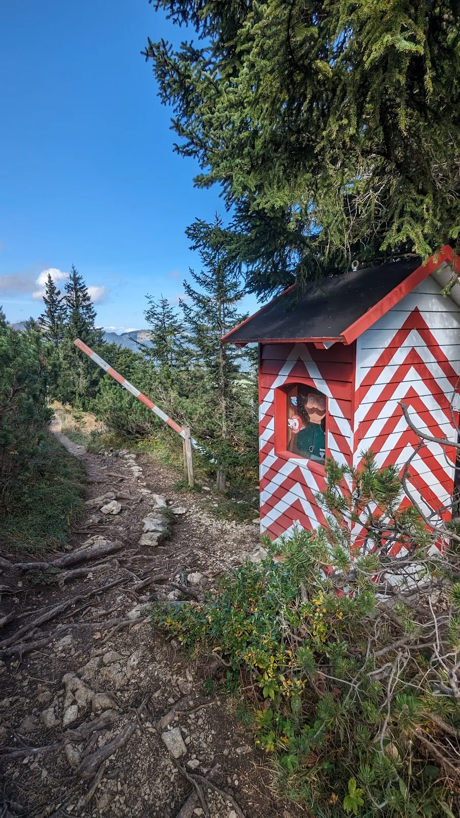
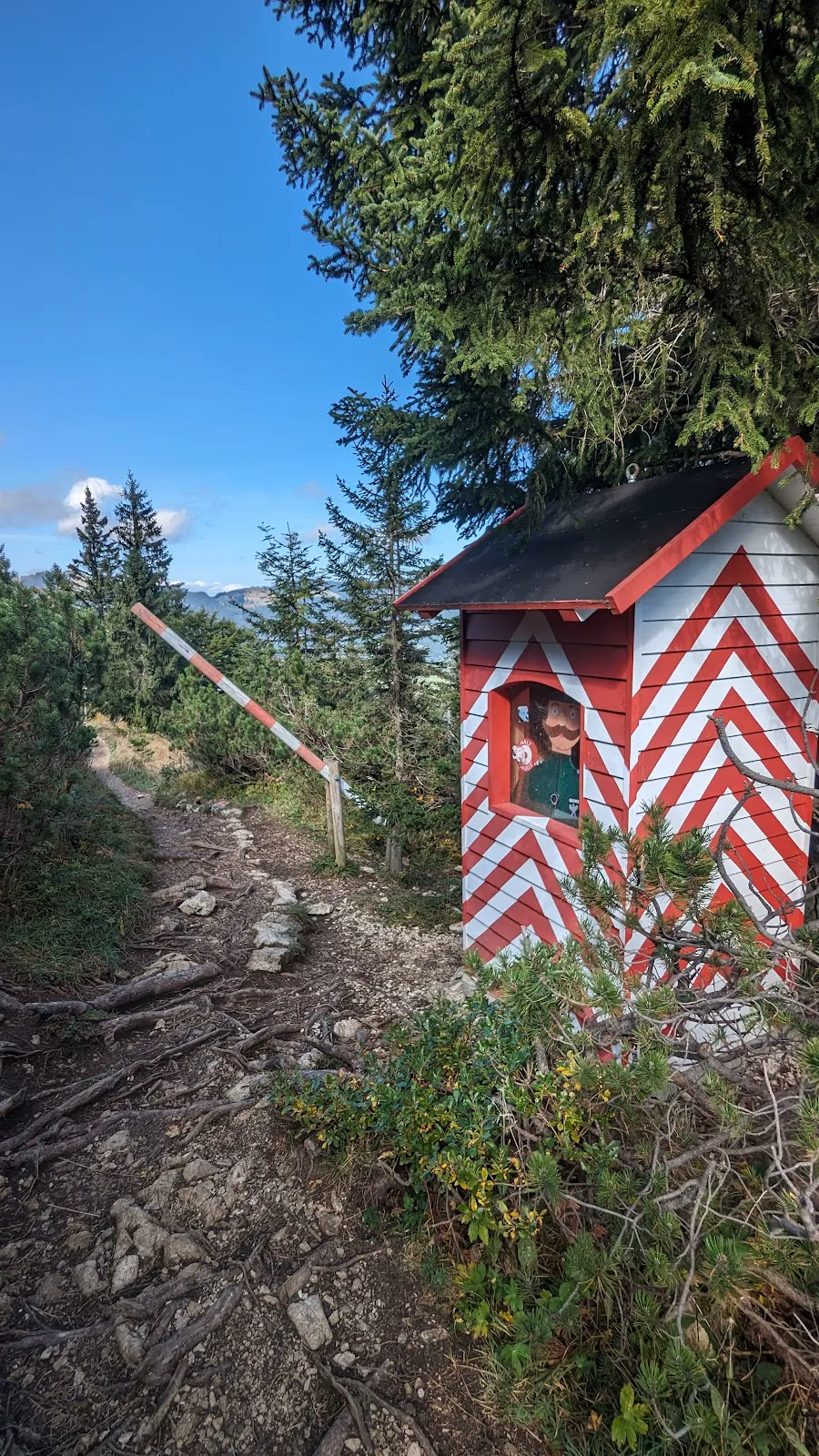
The Gamification Layer
The Role-Playing Engine
Upon purchasing a ticket, visitors are funneled into the narrative:
- The "Smuggler" Path: Mission is to carry "contraband" (symbolic) across the border without being caught.
- The "Border Guard" Path: Mission is to track and intercept smugglers.
- Implementation: Narrative delivered via booklet/pass stamped at checkpoints. Stations are physical installations—wooden structures, viewing platforms, or hidden boxes.
The Child Engagement Factor: This gamification is brilliant for engaging children (ages 6-12) who might otherwise complain about hiking. For adult thrill-seekers, the game is trivial, but the historical context adds intellectual interest that standard scenic trails lack. Walking the path knowing locals once risked prison or gunfire on this exact scree slope provides a sombre undertone to bright alpine scenery.
Implications for Thrill Seekers
- Noise Pollution: Children shouting "I found it!" echoes off limestone. Destroys the "solitude" aspect of alpine hiking.
- Traffic Jams: Stations create bottlenecks. Families stop to stamp books, blocking path. Fast hikers or trail runners will find this frustrating.
- Strategy: If not playing the game, simply bypass stations. Don't get stuck behind a family of five solving a riddle.
The Meteorological Playbook
The difference between miserable trudge and glorious alpine experience lies entirely in timing. The Tannheimer Tal, on the northern fringe of the Alps (Nordstau location), is susceptible to rapid weather changes.
The "Epic" Window
| Period | Conditions | Assessment |
|---|---|---|
| September - mid-October | Föhn winds clear July/August haze. Visibility extends 100km. Pastures turn golden-orange against white/grey limestone. | BEST TIME. Prime season for photography. Visual payoff 50% higher. |
| August | Peak Bavarian holiday season. Trail is conga line. South-facing slopes act as solar reflector—surprisingly hot, zero shade. High probability afternoon thunderstorms. | WORST TIME. Avoid. |
Weather Cancellation Reality
- Wind Sensitivity: Both Wannenjochbahn and Iselerbahn are sensitive to wind. If Föhn blows strong (common), lifts close. Trail remains open but requires 600m+ vertical hike from valley.
- Rain: Trail becomes mud bath in grassy sections. Operators don't "close" it—it just becomes miserable. Unlike rocky via ferratas which become dangerous, this trail just becomes messy.
Sunrise/Sunset Reality
- The Lift Constraint: Lifts run 08:40 - 16:30.
- Implication: Cannot capture true sunrise/sunset from ridge unless you hike up/down in dark (~1.5-2 hours each way).
- Night Options: None. No night hiking infrastructure on this ridge.
The Economic Impact: The Cost of Adventure
Adventure is not free. The "Hidden Cost" is the cable car ticket. While the hike itself is free, the linear route (Point A to Point B) usually necessitates paid transport.
| Cost Category | Details | Amount |
|---|---|---|
| Wander-Ticket (Adult) | Ascent one lift + descent other | ~€30 |
| Family of 4 | 2 adults, 2 children | €80-90 on lifts alone |
| Parking | Valley stations, monitored lots | €5-7/day |
| Bus Transfer | End in different village than start | Free with Gästekarte, or €3-5 |
Value Assessment
- For the Hike Alone: Poor value. €30 for a 4km walk is steep compared to global trekking destinations.
- For the Access: Good value. Ticket places you at 1,900m instantly, saving 2 hours of grueling uphill. For a climber heading to Salewa Klettersteig, the €30 is an "approach fee" that saves energy for the climb.
The Bus Trap: The route is linear—you end in a different village (Schattwald vs. Oberjoch). The Wanderbus is free with Gästekarte if you're staying in the valley. Day-trippers may need to pay ~€3-5. Critical: Check the RVO schedules. If you finish at 17:30, you might have missed the last bus, leaving you stranded in Oberjoch while your car is in Schattwald (a 5km paved road walk).
The "Combo" Ecosystem: Building the Ultimate Adventure Day
This is the "Secret Sauce." The Schmugglersteig is not the destination—it is the hub. Construct a "Full Adventure Day" that satisfies the adrenaline requirement by linking nearby assets.
The "Vertical Integration" Itinerary
Combines high-output climbing with scenic recovery of the Schmugglersteig:
| Time | Activity | Details |
|---|---|---|
| 08:30 | Arrival | Park at Oberjoch (Iselerbahn) |
| 09:00 | The Ascent | Take Iselerbahn up |
| 09:30 | THE MAIN EVENT: Salewa Klettersteig | Via Ferrata starting near summit station. Traverses Iseler face. Difficulty B/C. Exposure, vertical climbing, excellent views. Approx. 2-3 hours. Adrenaline: Moderate to High. |
| 12:30 | Summit Lunch | Eat at summit of Iseler |
| 13:30 | THE COOL DOWN: Schmugglersteig | Descend via the "family" trail towards Wannenjoch. Walking in the "downhill" direction = active recovery with views without exertion. |
| 15:00 | The Reward | Zipfelsalpe: rustic hut below ridge saddle. Kaiserschmarrn. Cash only. |
| 16:00 | The Descent | Take Wannenjochbahn down to Schattwald |
| 16:30 | The Loop | Take bus back to Oberjoch |
Nearby Food/Recovery
- Zipfelsalpe: Authentic hut. Wood-panelled, smells of pine and bacon. High-calorie Tyrolean staples. Cash only is the norm.
- Gundhütte: German side (descent from Wannenjoch towards Oberjoch). Good for quick beer before final descent.
Content Creation Gold: The "Shot" List
While adrenaline is low, visual yield is high. This is a primary driver for the modern "experience collector."
Top Photo Spots
- Wiedhag Alpe Vantage: Looking back from Iseler side towards Wannenjoch. Trail snakes along green ridge.
- Iseler Summit Cross: 20-minute detour from main Schmugglersteig takes you to absolute summit (1,876m). Massive cross. Steep drop-off to north. This is the "Hero Shot."
- Border Stones (Grenzsteine): Historical boundary markers scattered along path. Close-up of weathered stone with "T" (Tyrol) and "B" (Bavaria) engravings = strong detail shot.
Drone Usage
- Status: HIGH RISK. Not explicitly banned in all areas, but problematic for three reasons: (1) National border = different aviation authorities, (2) Near operating cable cars = strict no-fly zones, (3) Hotspot for paragliders = collision danger.
- Recommendation: Keep drone grounded. Use gimbal and wide-angle lens instead.
The Gear Locker
While the trail is easy, the environment is alpine. "Tourist" mistakes lead to misery.
Footwear: The "Grip" Imperative
- The Mistake: Sneakers/city shoes.
- The Reality: Limestone gravel acts like ball bearings. On descent sections, smooth-soled shoes will slide.
- Recommendation: Trail running shoes with aggressive lugs (Salomon Speedcross, Hoka Speedgoat). Heavy hiking boots (Category B/C) are overkill but acceptable. Approach shoes are excellent for sticky rubber if you plan to scramble on nearby rocks.
Layering: The Wind Factor
- The Ridge Effect: Walking a ridge at 1,900m. Exposed to Westerlies. Even on sunny 20°C valley day, wind chill on ridge can drop perceived temperature to 10°C.
- Essential Kit: Lightweight windshell (windbreaker). Weighs 100g, saves the day.
Social Dynamics and Crowd Intel
The Crowd Profile
- Dominant Group: German families (Munich/Stuttgart area) on weekend trips.
- The Vibe: Energetic, loud, chaotic. Not a place for meditative silence.
- Solo Traveler: You will feel invisible. Infrastructure (2-seater and 3-seater chairlifts, game stations) designed for groups. But nobody will bother you.
Insider Intel on Crowds
- The Lunch Spike: Between 12:00-13:30, trail is busiest as people migrate between lift stations and nearest huts.
- The "Golden Hour" Hack: For solitude, take first lift up (08:40) and walk fast— you'll be ahead of the family wave. OR take last lift up (16:00), hike one way, and walk down to the valley instead of taking lift. Evening light is superior and trail is empty.
Final Recommendations
- Do NOT drive 3 hours just for this. If this is the only activity, you will be underwhelmed by the lack of physical challenge.
- COMBINE with the Salewa Klettersteig. This turns the day from a "walk" into a "mission."
- Go in September. Visual payoff is 50% higher due to air clarity and autumn colors.
- Bring Cash. For the huts and parking.
- Ignore the "Game" unless you have children. The role-playing elements are a distraction. Focus on the geography and border history.
By positioning the Schmugglersteig as the "Active Recovery" day in a broader Tannheimer Tal itinerary, you validate its existence without over-selling its thrill, maintaining "Brutally Honest" trust.