The Brutally Honest Verdict
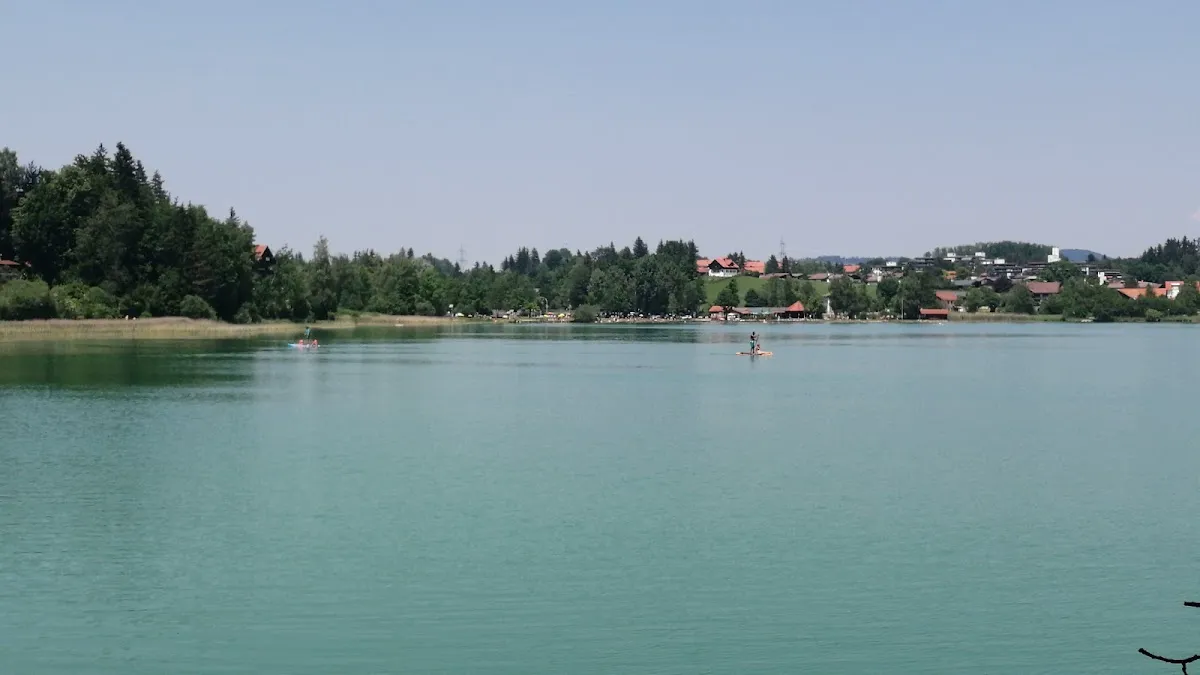
Marketed as "Terrainkurweg" (Terrain Cure Path), this 6.1km circuit is frequently portrayed as pristine nature loop. The reality: a hybrid facility functioning simultaneously as high-traffic suburban promenade AND moderately technical forest trail, depending on which sector you traverse. It's a scenic endurance walk, not a mountain expedition—but properly hacked, it has legitimate value.
The 75% Asphalt Reality
4.6km (75.64%) consists of asphalt or heavily compacted gravel. True "hiking" is strictly limited to 1.5km (24.35%) on South Shore. The term "Terrainkurweg" implies natural substrate—reality is heavily engineered.
The Castle Visibility Myth
Not a castle-viewing hike. Weissensee sits in trench separated from Hohenschwangau by ridges. Neuschwanstein is obscured. For castle views, try Schwansee or Alpsee instead.
The Acoustic Reality
B310 highway = constant companion on North Shore. Forget acoustic solitude. If silence matters, this trail fails. View payoff is Tannheim Alps panorama, not tranquility.
Counter-Clockwise Strategy
Start East, move South first. Tackles technical section with fresh legs. Keeps Tannheim mountain views forward instead of requiring constant turning.
The "Suppertime Hack"
Arrive after 17:00 in summer. Swimmers leaving, parking opens. Golden Hour light. Trail traffic drops 80%. Temperature manageable vs. daytime heat trap.
Coin Constraint
Card readers frequently "Out of Order." Connectivity spotty in mountain shadow. Always carry physical Euro coins (€1, €2, 50c). Enforcement is strict.
The Physical Filter
Felsentor (Rock Gate) on South Shore = impassable for strollers and casual cyclists. This detail is often buried in tourist maps.
Surface Composition Analysis
| Sector | Surface | Grade | Character |
|---|---|---|---|
| North Shore (Promenade) | Asphalt | T1/T0 | Fully accessible, wide, impossible to lose path. Highway noise constant. |
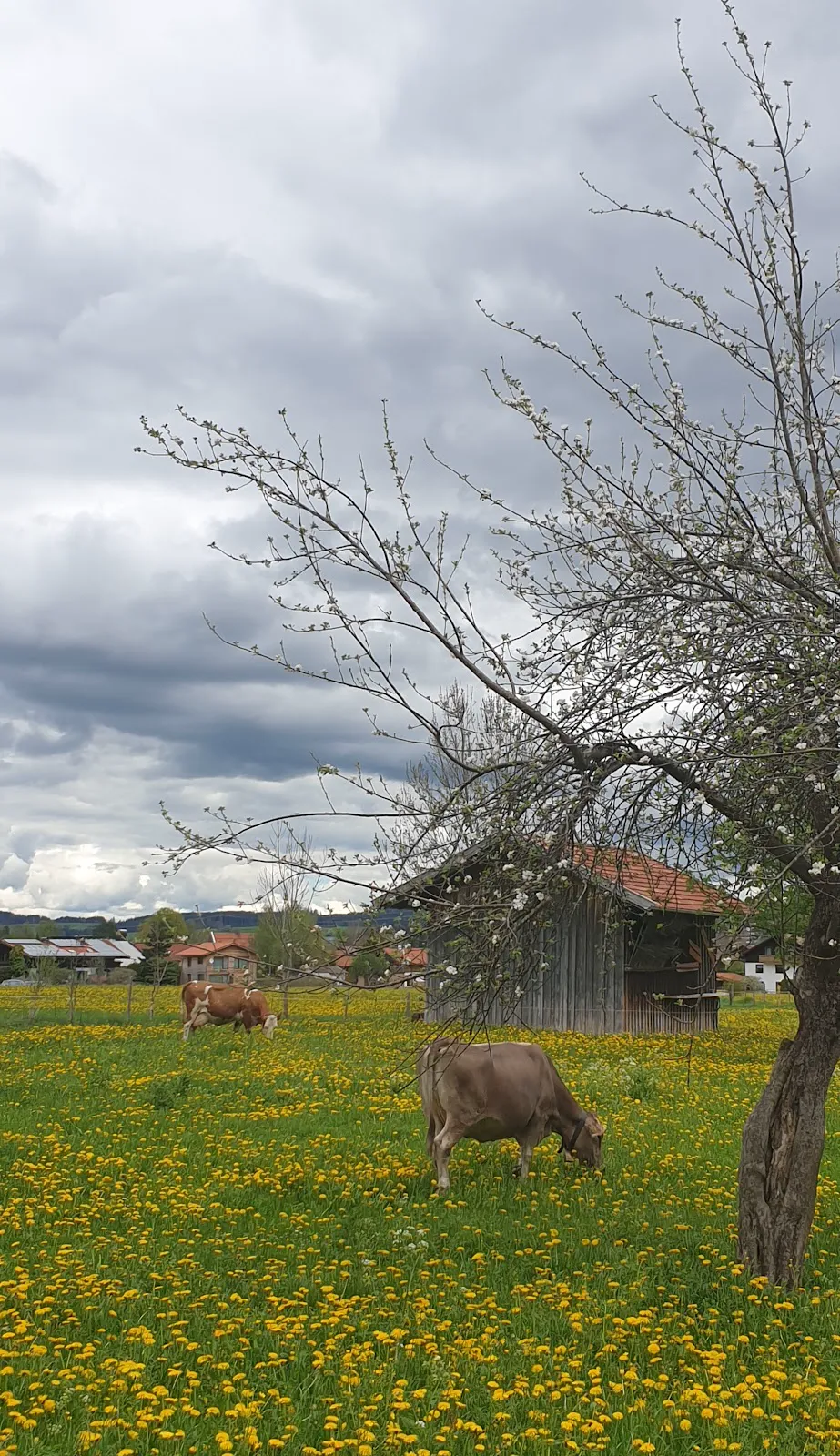
| West Shore (Meadows) | Compacted gravel | T1 | Fully exposed—zero canopy. Brutal at midday on 30°C day. |
| South Shore (Forest Trail) | Dirt, roots, limestone | T2 | Requires sure-footedness. Single-track, slick limestone slabs, intricate root steps. Deep shade, cool even in summer. |
| East Shore (Hub) | Asphalt/paved | T0 | Parking, Lido, Kiosk. Chaotic in summer with swimmers/paddleboaters. |
Footwear Recommendation: For this mix of pavement and rooty single-track, lightweight trail runners or approach shoes beat stiff B-category mountain boots (which become jarring on 4.6km of hardscape).
FELSENTOR HAZARD
The Rock Gate (Felsentor) on South Shore is the primary accident hotspot. Path passes through narrow limestone arch—polished smooth by decades of traffic. Even light rain = frictionless surface. Steep drop to lake on one side, cliff on other.
WINTER: Ice sheets persist for weeks (north-facing, no sun). Micro-spikes (Grödel) are ESSENTIAL, not optional.

Photography Strategy
| Viewpoint | Location | Best Light | Composition |
|---|---|---|---|
| The "Säuling Mirror" | West Shore meadows near playground | GOLDEN HOUR PRIME. Late afternoon/sunset. | Lake as foreground mirror for Säuling peak (2,047m). Sun behind you = Alpenglow on eastern peaks. |
| The Felsentor Frame | South Shore, halfway | Midday (11:00-14:00) | Shoot through limestone arch toward turquoise water. Heavily shaded—needs higher ISO or tripod. Water color pops when sun is high. |
| The Reed Beds | NW corner transition | Morning or evening | High grasses/reeds foreground with lake and mountains. Telephoto compression for waterfowl (Great Crested Grebes common). |
Seasonal Matrix
| Season | Conditions | Notes |
|---|---|---|
| Spring (May-June) | BOTANY WINDOW | Meadows in full bloom. High water levels = maximum reflections. Snowcaps on peaks add contrast. |
| Summer (Jul-Aug) | HIGH STRESS | Lake = swimming destination. Lido chaotic. Parking fills by 09:30. Solitude non-existent. |
| Autumn (Sep-Oct) | HIKER'S CHOICE | South Shore forest turns orange/gold. Lower sun angle = reduced glare. Morning fog burns off by noon = moody atmosphere. |
| Winter (Dec-Mar) | DANGER ZONE (South) | North Shore often cleared. South Shore NOT MAINTAINED. Ice sheets persist for weeks. Micro-spikes mandatory. |
Parking Matrix
| Lot | Capacity | Cost | Notes |
|---|---|---|---|
| P1: East Shore (Seepark/Freibad) | ~100+ | €1.50/hr; €5/day | Main Hub. Direct Lido access. Fills rapidly on summer weekends. |
| P2: Alatsee Lower Lot | ~60 | €5/day flat | STRATEGIC CHOICE. Often has space when P1 full. Good for Alatsee combo start. |
| P3: West Shore (Badestrand) | ~40 | €5/day | Sunset Specialist. Best for western meadows. Limited capacity; difficult to turn if full. |
GPS Coordinates:
- East Shore (Main Lot): 47.576809, 10.626689
- West Shore: 47.576, 10.605 (approximate)
THE CANOPYTOURS INSIDER HACK
Don't simply walk the loop. HACK the route.
The Strategy
- Park at Alatsee Lower Lot (P2)
- Hike UP to Alatsee first (~130-150m climb on Forstweg). Get heart rate up, experience the wilder, higher lake. The "Bleeding Lake" with purple sulphur bacteria at depth.
- Circumnavigate Alatsee (1.5km, flat, almost entirely gravel/dirt)
- Descend via "Oberer Magnusweg"—narrow, steep trail drops directly to Weissensee South Shore (significantly more technical than road)
- Walk West to Felsentor to see the rock formation
- Turn around and retrace or loop via Oberkirch meadows
Result: Maximizes time on "real" trails (South Shore + Alatsee climb). Completely eliminates noisy, asphalt-heavy North Shore promenade. Transforms tourist walk into legitimate, diverse hiking experience.
On-Trail Reality
Water & Hydration
- Sources: ZERO potable fountains on loop. Streams on South Shore = agricultural runoff (not safe without filtration).
- Recommendation: Carry minimum 1L per person, especially in summer (valley traps humidity, increases sweat rates even on flat sections).
- Resupply: Bottled water only at Kiosk (East Shore) or hotel restaurants.
Facilities
- East Shore: Public toilets at P1/Freibad (may require 50c coin)
- West Shore: Unreliable portable toilet in high season
- South Shore: ZERO facilities. Use East Shore before departing.
Connectivity
- North/West Shores: 4G/LTE robust (line-of-sight to towers)
- South Shore: Spotty to NON-EXISTENT near Felsentor. Rock face blocks signals. Download offline maps (Komoot/Bergfex) before entering.
The "Terrainkurweg" Reality
The designation is a certified status within the German health resort system. Not marketing—legitimate climatological therapy involving measured exertion.
The Physiology
- Cool Air Production: Forest and lake create "fresh air corridor" for respiratory/ cardiovascular therapy
- Metabolic Load: North Shore flatness = Zone 2 low-heart-rate endurance. South Shore undulations = interval-style resistance spikes.
Kneipp Facilities
Wassertretbecken (water treading pool) at Weissensee Kurpark (East end). Based on Sebastian Kneipp teachings.
Usage: After 6km loop, remove boots. Perform "Stork Walk" (lifting legs high) in freezing spring water. Highly effective, legitimate recovery technique for reducing inflammation in tired feet.
Practical Information
Final Verdict
Worth the Effort?
- YES for: Photographers chasing "Säuling Mirror" at sunset, trail runners needing measured 6km loop, families with children old enough to handle rooty South Shore but young enough for West Shore playground.
- NO for: Hikers expecting acoustic silence (B310 is constant companion) or wilderness experience.
The Weissensee Circuit is a foundational Allgäu experience, but it suffers from identity crisis in marketing. Frequently sold as "nature hike" when it's actually suburban alpine promenade with brief rugged interlude. Properly hacked via the Alatsee extension, it becomes something worthwhile.